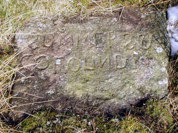
(Click photograph for a larger image)
Location: Some 80 metres from the Turf Pit track junction, at a bearing of 285°.
Latitude: 54.103237 Longitude: -1.960019
NGR: SE 02712 67486
Inscription: SUMMERS & CO FOUNDR
A 1m square stone lying on its back, alongside Meer Stone 27. A founder stone, this marks the south-west corner of the 6 meer lease held by Summers and Company, as shown on the 1781 Brailsford survey. The 'S' and 'N' are carved in mirror script. The lease is in the Turf Pits area lying over the North, South and Sun veins. A drawing of the stone may be found on page 3 in The Mines of Grassington Moor (see references). The Summers family originally came from Swaledale and were attracted to the area by the mining in the 1730s. This stone may be associated with John Summers who died in 1791.