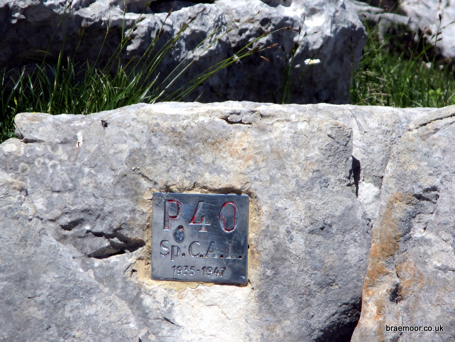
P40
Northing: 45.312488° Easting: 5.853513° Altitude: 1,939 m
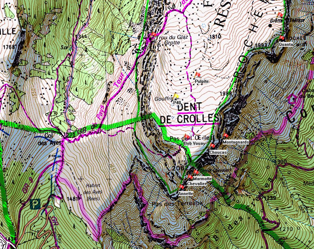
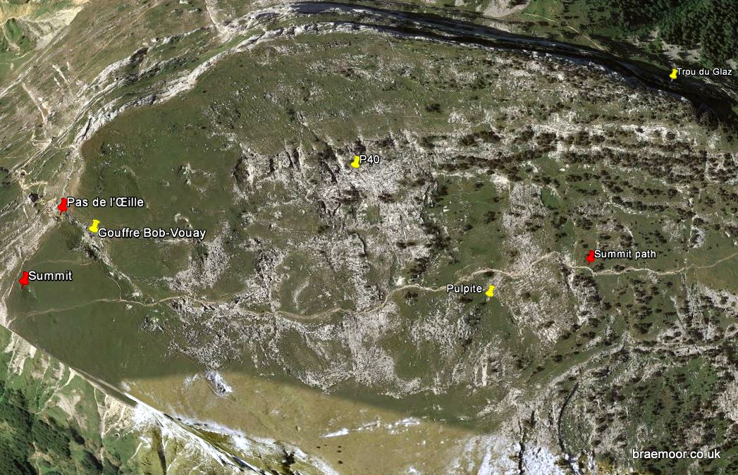
How to find it
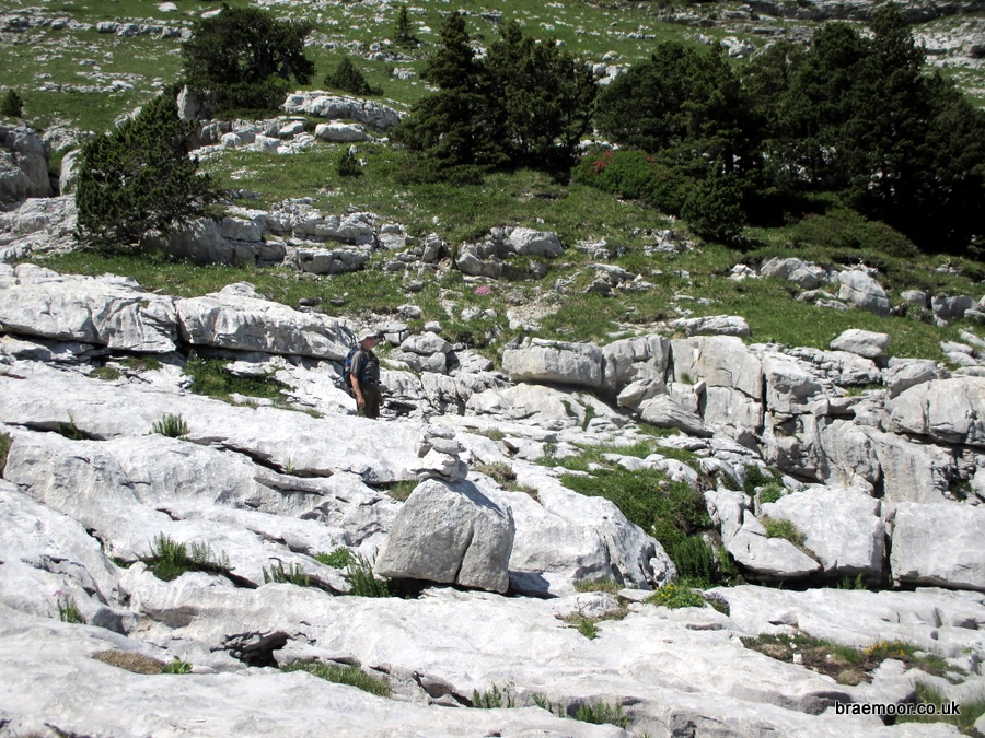
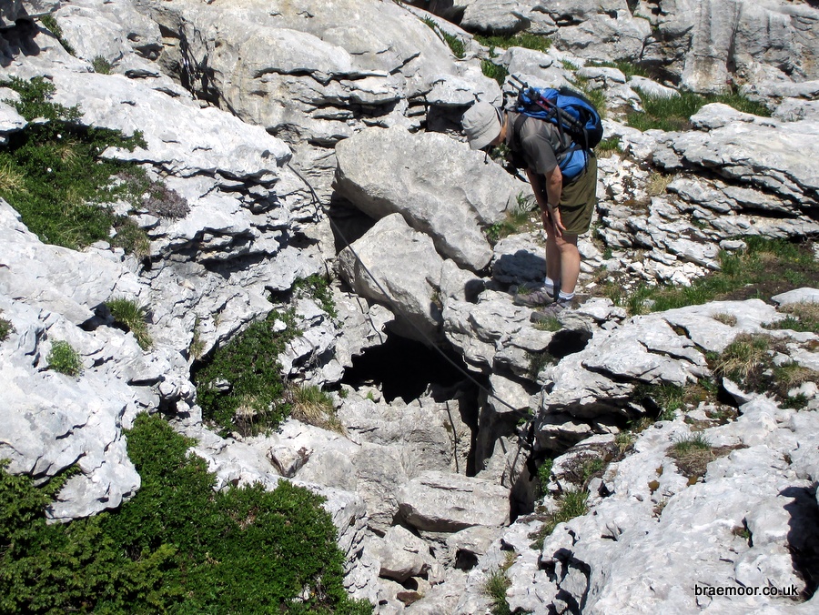
Follow the waymarked GR9 from the Col du Coq past the Trou du Glaz onto the plateau above. At a signposted junction follow the path up towards the summit. After about 350 metres an obvious spoil heap 40 metres on the left marks the location of Gouffre Pulpite. Continue up the main path for a further 130 m past a line of trees and a small escarpment on the right. Wander across the pavement to the right, past a large doline, and pick up a line of cairns which lead to the narrow entrance which is marked with a metal plaque. It is about 170 m from the path, and close to the start of the grassy rise up to the western crête - closer than indicated on the IGN 1:25000 map. It can also be approached from above via Pas de l'Œille which is more direct, but that is a better route for descent rather than ascent.
Further information
P40 was the original plateau entrance to the Réseau de la Dent de Crolles. Explored from below, the connection with the surface shaft was blasted open by Chevalier's team in 1947, and now P40 to Trou du Glaz is a classic traverse, with a height difference of 238 m. There are a number of detailed descriptions of the through trip available on the web, but with much of the route being in meanders, there are a number of variations. The best and most detailed is that produced by Spéléo Secours Isère, the local rescue organisation, which follows a route equipped with pull-through chains and pitch head traverse lines. The trip requires a couple of 35 m ropes, and typically takes about 6 hours, and should only be attempted in reasonably dry weather. It is characterised by traversing in meanders and some wet pitches, but once it drops into Salle des Douches in Trou du Glaz, it is a straightforward exit through easy waymarked passages. The traverse can be extended by exiting through Grotte Annette Bouchacourt or Grotte du Guiers Mort if 40 m ropes are used.
The Spéléo Secours Isère route guide for the P40 to Trou du Glaz traverse has been loosely translated by the author, and is available here. Use at your own risk...