Introduction
Dent de Crolles is the high point of an extensive upland massif in the Chartreuse hills of the French Prealps. Its summit of 2,062 metres dominates the Grésivaudan valley to the south, whilst to the north a tilted synclinal plateau, protected by high cliffs on the west and east, descends for 1½ km to the edge of a cliff-encircled cirque overlooking the Perquelin valley, some 3 km ESE of St. Pierre de Chartreuse. To the south-west of the summit, a road ascends to 1,434 m at the Col du Coq where there is easy access to the plateau along the waymarked GR9 footpath. The hill owes its name to its resemblance to a giant molar when seen from the village of Crolles in the valley below.

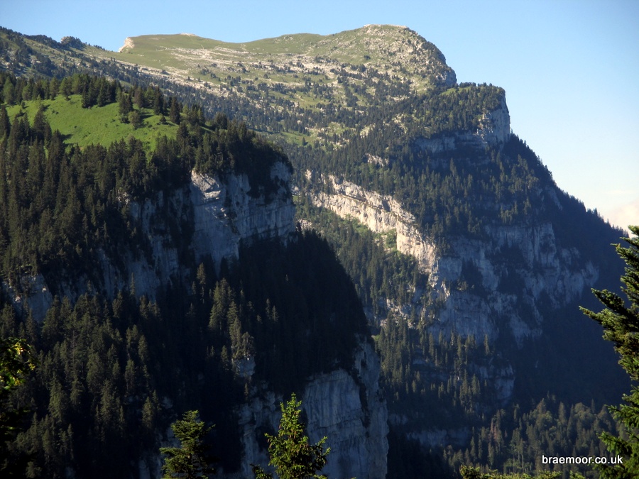
Col du Coq is bottom centre, and Perquelin right of top centre
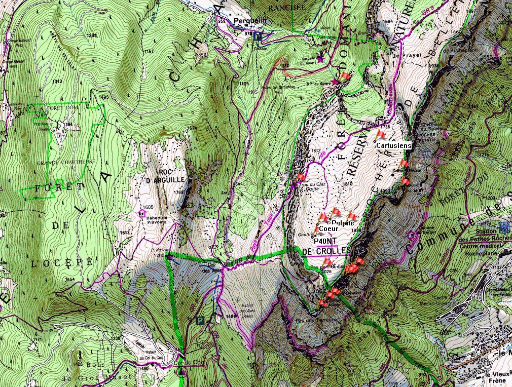
The flags mark the location of most of the entrances
Mesozoic in age, Dent de Crolles is capped by Urgonian limestones deposited during the Aptian and Berremian stages of the Early Cretaceous (c. 129 Ma – 120 Ma), overlaying impervious Hauterivian marls. The limestones are honeycombed by an extensive cave system, the Réseau de la Dent de Crolles. This has over 60 km of interconnected passages lying beneath a surface area of just 1.8 km² – one of the highest ratios of cave passage to bedrock in the world; and eighteen entrances including the resurgence, and a top entrance located just 150 m from the summit.
The system consists of a number of active passages fed by autogenic recharge that flow into a master cave, and a labyrinth of far older large fossil multi-level phreatic passages. These were formed from the early Pliocene (circa 4.5 Ma) onwards, and drained landscapes long disappeared (see note). They were truncated during the Quaternary glaciations, and now have large entrances overlooking deep valleys in the north, east, south, and west cliffs of the massif. The fossil passages have been intercepted by the active passages to create a vast network, the plan survey of which has been likened to a plate of spaghetti. Although the limestone beds are only about 450 metres thick, the local geological structures means that the system is only a little shy of 700 metres deep.

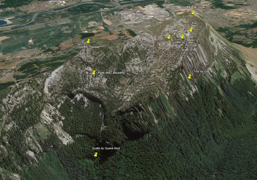
The highest entrance is near the col left of top centre, and the resurgence is bottom right of centre
The Réseau de la Dent de Crolles provides perfect holiday caving in a beautiful area, with many classic through-trips and round-trips available of varying degrees of difficulty, as well as providing scope for more challenging expedition-style caving. It is possible to traverse from the top of the mountain to near its base, and through the mountain from one side to the other, and combinations of the two. The more popular routes are waymarked and superbly equipped with pull-through chains and traverse lines. Some through-trips take around 4 hours, and others over 12 hours. All the entrances are reasonably accessible, with the walk-ins varying between about ¾ of an hour, and two hours. The active systems become hostile at best, and impassable at worst, in times of high snow melt and heavy rain, but there are plenty of safe routes to choose from when its wet.
The purpose of this website is to pull together the latest definitive published information on the system. It was last updated in February 2024. Please look at the Sources of information page for a summary of available material, much of it on the web. Information on the more recent discoveries is not available on the web, but is available on bone fide request.
The following 18 entrances, ordered by altitude, are known. Entrances with hyperlinked names are discussed further on this site. The locations can be seen displayed on the IGN Géoportail aerial photography website, on a map created by Gilbert Bohec. The entrances are shared between three communes, all in the département de l'Isère – St. Pierre de Chartreuse to the north; St. Pancrasse to the south; and St. Hilaire to the east. The expression "equipped route" in the Notes column indicates that a route between that entrance and those mentioned have been equipped with pull-through chains and traverse lines to enable through trips to be undertaken.
| Name | Northing | Easting | Altitude | Commune | Linked | Notes |
|---|---|---|---|---|---|---|
| Gouffre Bob Vouay | 45.30960° | 5.85445° | 2,015 m | St. P. de Ch. | 2009 | 200 m from and 47 m below the summit Equipped routes to Trou du Glaz and Grotte Chevalier |
| P40 | 45.312488° | 5.853513° | 1,939 m | St. P. de Ch. | 1947 | On the plateau Equipped route to Trou du Glaz |
| Gouffre des Quanta | 45.31679° | 5.86455° | 1,937 m | St. Hilaire | 2001 | In the eastern face Links with Grotte du Guiers Mort Accessed by a 50 m abseil down the eastern cliffs |
| Gouffre Thérèse | 45.318150° | 5.864574° | 1,933 m | St. P. de Ch. | 1975 | On the plateau near Rocher du Midi Equipped route to Grotte du Guiers Mort |
| Gouffre du Coeur | 45.3136° | 5.8542° | 1,910 m? | St. P. de Ch. | 2023 | On the plateau Links with Trou du Glaz Enters the Réseau des Polonais |
| Gouffre de la Pulpite Irréversible | 45.314053° | 5.855845° | 1,900 m | St. P. de Ch. | 2010 | On the plateau Equipped route to Trou du Glaz. Also links with Grotte du Guiers Mort |
| le Nid de Choucas | 45.3089° | 5.8571° | 1,890 m | St. Hilaire | 2021 | In the eastern face Discovered from below by scaling in the Grotte Chevalier. |
| Puits des Cartusiens | 45.320803° | 5.861758° | 1,783 m | St. P. de Ch. | 2007 | On the plateau Links with Grotte du Guiers Mort |
| Grotte des Excités | 45.3089° | 5.8575° | 1,751 m | St. Hilaire | 2022 | Discovered by climbing up the eastern face Links with Grotte Chevalier |
| le Balcon | 45.3091° | 5.8578° | 1,750 m | St. Hilaire | 2022 | In the eastern face Discovered from Grotte des Excités |
| Grotte des Montagnards | 45.3096° | 5.8585° | 1,749 m | St. Hilaire | 1966 | In the eastern face Entered and linked with Grotte Chevalier in 1966 |
| l'Entrée des Artistes | 45.3089 | 5.8575° | 1,745 m | St. Hilaire | 2022 | In the eastern face Discovered from Grotte des Excités |
| Grotte Annette Bouchacourt | 45.305975° | 5.853711° | 1,718 m | St. Pancrasse | 1946 | In the southern face Exit for equipped route from Trou du Glaz |
| Grotte Chevalier | 45.307° | 5.85468° | 1,701 m | St. Pancrasse | 1984 | In the southern face Exit for equipped routes from Trou du Glaz and Vouay Links with entrances high in the southern cliffs |
| Trou du Glaz | 45.317272° | 5.851502° | 1,692 m | St. P. de Ch. | ---- | In the western face Equipped routes to Guiers Mort, Annette and Chevalier Exit for equipped routes from P40, Pulpite and Vouay Equipped round trip |
| Maxi Méga Marmotte | 45.307016° | 5.855318° | 1,679 m | St. Pancrasse | 2020 | In the southern face Alternative entrance/exit into/from Grotte Chevalier |
| Grotte Bis du Guiers Mort | 45.3261° | 5.8578° | 1,340 m? | St. P. de Ch. | 2023 | In the northern face Subsidiary entrance to Guiers Mort |
| Grotte du Guiers Mort | 45.32611° | 5.85757° | 1,334 m | St. P. de Ch. | 1941 | In the northern face Exit for equipped routes from Trou du Glaz and Thérèse Also links with Gouffres Quanta, Cartusiens, and Pulpite Two equipped round trips |
| All locations supplied by Gilbert Bohec. The caves with locations specified to six decimal places were fixed to a high degree of accuracy in early 2022. Heights with question marks are educated guesses. | ||||||
The following files are available for importing entrance location details:
- Reseau de la Dent de Crolles.gpx - for importing into GPS and Memory-Map etc. (7.0 KB)
- Reseau de la Dent de Crolles.kmz - for importing into Google Earth (1.7 MB).
In addition to the caving, the area also offers magnificent walking, as well as ample opportunities for big route climbing, sport climbing, canyoning, and via ferratas. For more information on the area, consult the author's Chartreuse website.

With acknowledgements to Google Earth.
Acknowledgements
I would like to thank Gilbert Bohec, Dagobert L'Ecluse, and Glenn Jones for their help and advice given during the development of this website; Gilbert Bohec, Dave Checkley, Graham Coates, Stuart Heseltine and Pete Monk for their kind permission to use their photographs; and the many authors and organisations who have generously shared the results of their expertise on the Web. Errors and omissions are all mine.
Note 1
The early Pliocene date has been extrapolated from work done on the age of sediments in the caves of Mont Granier. See: Hobléa, Fabien & Häuselmann, Philipp & Kubik, Peter. (2011). Cosmogenic nuclide dating of cave deposits of Mount Granier (Hauts de Chartreuse Nature Reserve, France): morphogenic and palaeogeographical implications Géomorphologie : relief, processus, environnement. 395-406.
