
Pas de la Rousse
Starting point: Pré Orcel Difficulty: 2+ Ascent: 420 m Time: 5½ hrs Quality: **
The eastern side of of the Chartreuse Massif is protected by a band of cliffs stretching from Dent de Crolles in the south, to Mont Granier in the north. In some areas these cliffs are vertical, and in others they are a complex of largely inaccessible cirques and sangles, hiding a wonderland of hidden gems such as la Tour Percée. This walk provides another opportunity to get up close and personal with the area, ascending by the Pas de la Rousse to reach the Crête du Forneau. The ascent is reasonably waymarked, but it is steep and pretty loose for much of the way, and includes a few easy scrambles, and is high in its grade on that account. It is not recommended as a descent route. Once at the top, the route follows the ridge north to the Croix de l'Alpe, and descends the short but sweet Pas de Belles Ombres (map). It can easily be covered in four hours but, weather permitting, it is best take your time and enjoy it.
The starting point is Pré Orcel (1405 m, grid ref. UTM 31T 72985 50340). This is reached from les Prés along 4½ km of bumpy forest track. There is a large parking area, information boards, and a water source here. From the car park, take the small path that heads south from the the fountain. This is a delightful path that traverses through the forest. After 20 minutes the path crosses a scree slope where a blue marker blob may be seen on a boulder. We ascend the scree, which is steep and loose. In a further 20 minutes the cliff is reached with a large cave entrance - this is the Trou de la Rousse, and it is worth investigating with its impressive entrance chamber. Seven intact ceramic pots from Lombardy dating from the Bronze Age (about 1300 B.C.) were found here.
From the cave, following blue blobs, the path ascends below the cliffs, sometimes necessitating the odd scramble, and at one point traversing across a slab about 4 metres long. Nowhere is the scrambling hard, but the ground below is always steep and the scenery dramatic. After 45 minutes the upper cliffs are reached, and the path makes its way round to a weakness where a short climb up a final greasy gully reaches the crête, where there are wonderful views towards Mont Granier to the north, and the Col du Bellefont to the south. Apart from the scrabble up the scree at the bottom, it's a fun ascent, but care is required for much of the way.
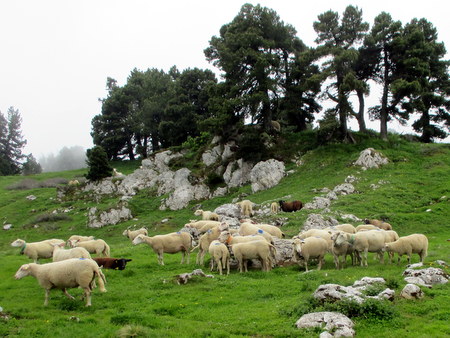
Once at the crête, we turn north. This section of path is very beautiful, traversing a broad ridge with dwarf pines, and hidden glades, made use of by the local sheep. Within a few minutes the path starts to descend, to arrive at a col after a further 20 minutes. Straight ahead, carved inscriptions on the rock denote the 1822 boundary between France and the Kingdom of Sardinia's Savoy territory - the red and white cross being the coat of arms of Savoy, and the fleur de lys being the official emblem of the kings of France. Ignore the path going off to the left, and head towards this. This path ascends a little before emerging at the head of the Vallon de Practel. The Col de l'Alpe which lies at the head of the Pas de l'Alpe, embellished with a boundary stone, is soon reached, and the Croix de l'Alpe lies a couple of minutes above. A good place for a second lunch.
From the Croix de l'Alpe make your way down towards the north-east taking one of a number of paths according to taste. The best, but not necessarily the fastest, traverses the ridge overlooking the Grésivaudan valley. Some 20 minutes after leaving the cross, a path is met in a shallow valley heading east - the start of the Pas de Belle Ombres. This is a fine descent, but a little care is required in the upper reaches. At a clearing with a cairn, there is a sharp right hand turn with the way to the Sangle de Belles Ombres going off to the left, and soon after, it looks as if the way is straight on, but is, in fact, to the left over a limestone pavement. Keep a watchful eye open for paint blobs. The main Pas de l'Alpe track is soon reached, and we follow this past a couple of hairpins down to the Cabane Forestière de l'Allier. A few metres beyond, the path back to Pré Orcel is on the right - take this and arrive back at the car about an hour after leaving the Croix de l'Alpe.