
Digital Elevation Model of the Chartreuse Massif
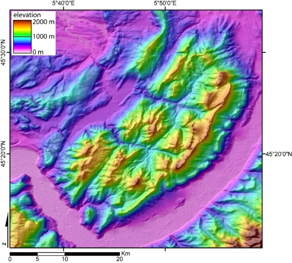
Digital Elevation Model of the Chartreuse massif created by jide from the 90 m pixel size SRTM dataset. The broad valley to the SW and SE is the Isère valley. The mountains to the south-east is the Belledonne massif, and to the south-west the Vercors massif. The city of Grenoble lies in the Isère valley, at the very south of the Chartreuse massif. You can identify the various parts of the area by hovering your mouse over the image.
The image and some of the text above has been reproduced under the GNU Free Documentation Licence with thanks, and originates from the Wikipedia.